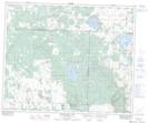
Maps showing Big Shell, Saskatchewan
Big Shell is a Village located in Saskatchewan and has an elevation of 578 meters.
- Latitude: 53° 11' 50'' North (decimal: 53.1971555)
- Longitude: 107° 8' 8'' West (decimal: -107.1354827)
- Topography Feature Category: Village
- Geographical Feature: Resort Village
- Canadian Province/Territory: Saskatchewan
- Elevation: 578 meters
- Atlas of Canada Locator Map: Big Shell
- GPS Coordinate Locator Map: Big Shell Lat/Long
Big Shell NTS Map Sheets