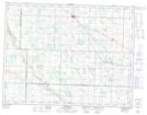
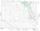
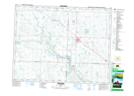
Maps showing Gopher Creek, 1-12-30-W, Saskatchewan
Gopher Creek is a River located in 1-12-30-W, Saskatchewan and has an elevation of 562 meters.
- Latitude: 49° 59' 20'' North (decimal: 49.9888892)
- Longitude: 101° 26' 57'' West (decimal: -101.4490889)
- Topography Feature Category: River
- Geographical Feature: Creek
- Canadian Province/Territory: Saskatchewan
- Elevation: 562 meters
- Location: 1-12-30-W
- Atlas of Canada Locator Map: Gopher Creek
- GPS Coordinate Locator Map: Gopher Creek Lat/Long
Gopher Creek NTS Map Sheets