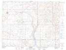
Maps showing Ardill, 25-11-29-W2, Saskatchewan
Ardill is a Hamlet located in 25-11-29-W2, Saskatchewan and has an elevation of 684 meters.
- Latitude: 49° 56' 21'' North (decimal: 49.9392333)
- Longitude: 105° 50' 31'' West (decimal: -105.8419944)
- Topography Feature Category: Hamlet
- Geographical Feature: Organized Hamlet
- Canadian Province/Territory: Saskatchewan
- Elevation: 684 meters
- Location: 25-11-29-W2
- Atlas of Canada Locator Map: Ardill
- GPS Coordinate Locator Map: Ardill Lat/Long
Ardill NTS Map Sheets