Maps showing Tannahill, 19-11-25-W3, Saskatchewan
Tannahill is a Unincorporated area located in 19-11-25-W3, Saskatchewan.
- Latitude: 49° 55' North (decimal: 49.9167069)
- Longitude: 109° 25' West (decimal: -109.4174189)
- Topography Feature Category: Unincorporated area
- Geographical Feature: Railway Point
- Canadian Province/Territory: Saskatchewan
- Location: 19-11-25-W3
- GPS Coordinate Locator Map: Tannahill Lat/Long
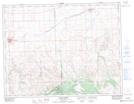
Tannahill NTS Map Sheets