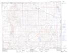
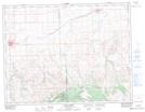
Maps showing Junction Reservoir, 11,12-26-W3, Saskatchewan
Junction Reservoir is a Lake located in 11,12-26-W3, Saskatchewan and has an elevation of 744 meters.
- Latitude: 49° 57' North (decimal: 49.9500427)
- Longitude: 109° 30' West (decimal: -109.5007570)
- Topography Feature Category: Lake
- Geographical Feature: Reservoir
- Canadian Province/Territory: Saskatchewan
- Elevation: 744 meters
- Location: 11,12-26-W3
- Atlas of Canada Locator Map: Junction Reservoir
- GPS Coordinate Locator Map: Junction Reservoir Lat/Long
Junction Reservoir NTS Map Sheets