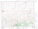
Maps showing Edgell, 24-10-23-W3, Saskatchewan
Edgell is a Unincorporated area located in 24-10-23-W3, Saskatchewan and has an elevation of 964 meters.
- Latitude: 49° 50' North (decimal: 49.8333639)
- Longitude: 109° 1' West (decimal: -109.0173976)
- Topography Feature Category: Unincorporated area
- Geographical Feature: Locality
- Canadian Province/Territory: Saskatchewan
- Elevation: 964 meters
- Location: 24-10-23-W3
- Atlas of Canada Locator Map: Edgell
- GPS Coordinate Locator Map: Edgell Lat/Long
Edgell NTS Map Sheets