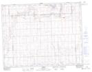
Maps showing Illerbrun, 36-11-18-W3, Saskatchewan
Illerbrun is a Unincorporated area located in 36-11-18-W3, Saskatchewan and has an elevation of 888 meters.
- Latitude: 49° 56' North (decimal: 49.9333655)
- Longitude: 108° 21' West (decimal: -108.3506991)
- Topography Feature Category: Unincorporated area
- Geographical Feature: Locality
- Canadian Province/Territory: Saskatchewan
- Elevation: 888 meters
- Location: 36-11-18-W3
- Atlas of Canada Locator Map: Illerbrun
- GPS Coordinate Locator Map: Illerbrun Lat/Long
Illerbrun NTS Map Sheets