Canada Topographic Maps

Skull Creek Topo Maps

Topography maps and Latitude/Longitude Location

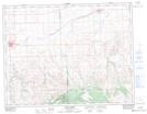
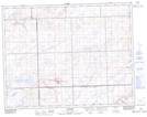
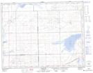
Maps showing Skull Creek, 13-22-W3, Saskatchewan

Skull Creek is a River located in 13-22-W3, Saskatchewan and has an elevation of 766 meters.

  • Latitude: 50° 3' North   (decimal: 50.0500349)
  • Longitude: 108° 58' West   (decimal: -108.9673945)
  • Topography Feature Category: River
  • Geographical Feature: Creek
  • Canadian Province/Territory: Saskatchewan
  • Elevation: 766 meters
  • Location: 13-22-W3
  • Atlas of Canada Locator Map: Skull Creek
  • GPS Coordinate Locator Map: Skull Creek Lat/Long

Skull Creek NTS Map Sheets

072F14 Maple Creek Topographic Map at 1:50,000 scale

072F15 Skull Creek Topographic Map at 1:50,000 scale

072K02 Tompkins Topographic Map at 1:50,000 scale

072K03 Crane Lake Topographic Map at 1:50,000 scale

072F Cypress Lake Topographic Map at 1:250,000 scale

072K Prelate Topographic Map at 1:250,000 scale

 
Buy Topographic Maps DVD
Newsletter Sign-up

Yes, I want to receive map store discounts.


Bookmark and Share