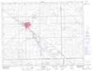
Maps showing Yellow Grass Ditch, Saskatchewan
Yellow Grass Ditch is a Hydraulic construction located in Saskatchewan and has an elevation of 577 meters.
- Latitude: 49° 52' North (decimal: 49.8666969)
- Longitude: 104° 7' West (decimal: -104.1172211)
- Topography Feature Category: Hydraulic construction
- Geographical Feature: Ditch
- Canadian Province/Territory: Saskatchewan
- Elevation: 577 meters
- Atlas of Canada Locator Map: Yellow Grass Ditch
- GPS Coordinate Locator Map: Yellow Grass Ditch Lat/Long
Yellow Grass Ditch NTS Map Sheets