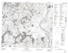
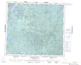
Maps showing Lewis Falls, Saskatchewan
Lewis Falls is a Falls located in Saskatchewan and has an elevation of 430 meters.
- Latitude: 56° 13' North (decimal: 56.2167492)
- Longitude: 106° 33' West (decimal: -106.5505772)
- Topography Feature Category: Falls
- Geographical Feature: Falls
- Canadian Province/Territory: Saskatchewan
- Elevation: 430 meters
- Atlas of Canada Locator Map: Lewis Falls
- GPS Coordinate Locator Map: Lewis Falls Lat/Long
Lewis Falls NTS Map Sheets