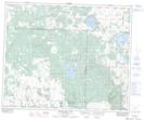
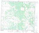
Maps showing Paddling Lake, 26-49-8-W3, Saskatchewan
Paddling Lake is a Unincorporated area located in 26-49-8-W3, Saskatchewan and has an elevation of 598 meters.
- Latitude: 53° 15' North (decimal: 53.2500498)
- Longitude: 107° 4' West (decimal: -107.0672489)
- Topography Feature Category: Unincorporated area
- Geographical Feature: Locality
- Canadian Province/Territory: Saskatchewan
- Elevation: 598 meters
- Location: 26-49-8-W3
- Atlas of Canada Locator Map: Paddling Lake
- GPS Coordinate Locator Map: Paddling Lake Lat/Long
Paddling Lake NTS Map Sheets