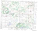
Maps showing Arran, 6-34-30-W, Saskatchewan
Arran is a Village located in 6-34-30-W, Saskatchewan and has an elevation of 461 meters.
- Latitude: 51° 53' 4'' North (decimal: 51.8844680)
- Longitude: 101° 43' 7'' West (decimal: -101.7186203)
- Topography Feature Category: Village
- Geographical Feature: Village
- Canadian Province/Territory: Saskatchewan
- Elevation: 461 meters
- Location: 6-34-30-W
- Atlas of Canada Locator Map: Arran
- GPS Coordinate Locator Map: Arran Lat/Long
Arran NTS Map Sheets