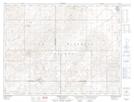
Maps showing Crystal Hill, 19-10-24-W2, Saskatchewan
Crystal Hill is a Unincorporated area located in 19-10-24-W2, Saskatchewan and has an elevation of 728 meters.
- Latitude: 49° 50' North (decimal: 49.8333653)
- Longitude: 105° 15' West (decimal: -105.2505570)
- Topography Feature Category: Unincorporated area
- Geographical Feature: Locality
- Canadian Province/Territory: Saskatchewan
- Elevation: 728 meters
- Location: 19-10-24-W2
- Atlas of Canada Locator Map: Crystal Hill
- GPS Coordinate Locator Map: Crystal Hill Lat/Long
Crystal Hill NTS Map Sheets