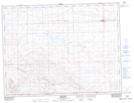
Maps showing Frontier, 13-3-20-W3, Saskatchewan
Frontier is a Village located in 13-3-20-W3, Saskatchewan and has an elevation of 907 meters.
- Latitude: 49° 12' 16'' North (decimal: 49.2045194)
- Longitude: 108° 33' 42'' West (decimal: -108.5617971)
- Topography Feature Category: Village
- Geographical Feature: Village
- Canadian Province/Territory: Saskatchewan
- Elevation: 907 meters
- Location: 13-3-20-W3
- Atlas of Canada Locator Map: Frontier
- GPS Coordinate Locator Map: Frontier Lat/Long
Frontier NTS Map Sheets