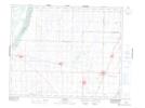
Maps showing Gruenfeldt, Saskatchewan
Gruenfeldt is a Unincorporated area located in Saskatchewan.
- Latitude: 52° 26' North (decimal: 52.4333804)
- Longitude: 106° 38' West (decimal: -106.6339312)
- Topography Feature Category: Unincorporated area
- Geographical Feature: Hamlet
- Canadian Province/Territory: Saskatchewan
- GPS Coordinate Locator Map: Gruenfeldt Lat/Long