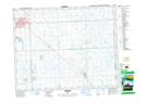
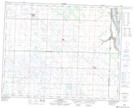
Maps showing Kessock, 2-26-33-W2, Saskatchewan
Kessock is a Unincorporated area located in 2-26-33-W2, Saskatchewan and has an elevation of 534 meters.
- Latitude: 51° 13' North (decimal: 51.2166615)
- Longitude: 102° 0' West (decimal: -102.0004672)
- Topography Feature Category: Unincorporated area
- Geographical Feature: Locality
- Canadian Province/Territory: Saskatchewan
- Elevation: 534 meters
- Location: 2-26-33-W2
- Atlas of Canada Locator Map: Kessock
- GPS Coordinate Locator Map: Kessock Lat/Long
Kessock NTS Map Sheets