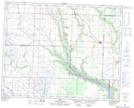
Maps showing Runnymede, 6-29-30-W, Saskatchewan
Runnymede is a Hamlet located in 6-29-30-W, Saskatchewan and has an elevation of 510 meters.
- Latitude: 51° 28' 54'' North (decimal: 51.4815749)
- Longitude: 101° 42' 5'' West (decimal: -101.7014310)
- Topography Feature Category: Hamlet
- Geographical Feature: Organized Hamlet
- Canadian Province/Territory: Saskatchewan
- Elevation: 510 meters
- Location: 6-29-30-W
- Atlas of Canada Locator Map: Runnymede
- GPS Coordinate Locator Map: Runnymede Lat/Long