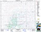
Maps showing Rushville, 31-30-15-W2, Saskatchewan
Rushville is a Unincorporated area located in 31-30-15-W2, Saskatchewan.
- Latitude: 51° 39' North (decimal: 51.6500209)
- Longitude: 104° 7' West (decimal: -104.1171973)
- Topography Feature Category: Unincorporated area
- Geographical Feature: Locality
- Canadian Province/Territory: Saskatchewan
- Location: 31-30-15-W2
- Atlas of Canada Locator Map: Rushville
- GPS Coordinate Locator Map: Rushville Lat/Long
Rushville NTS Map Sheets