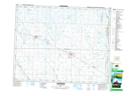
Maps showing Smith Creek, 25-21-30-W, Saskatchewan
Smith Creek is a River located in 25-21-30-W, Saskatchewan and has an elevation of 453 meters.
- Latitude: 50° 50' 15'' North (decimal: 50.8374957)
- Longitude: 101° 30' 32'' West (decimal: -101.5087949)
- Topography Feature Category: River
- Geographical Feature: Creek
- Canadian Province/Territory: Saskatchewan
- Elevation: 453 meters
- Location: 25-21-30-W
- Atlas of Canada Locator Map: Smith Creek
- GPS Coordinate Locator Map: Smith Creek Lat/Long
Smith Creek NTS Map Sheets