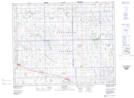
Maps showing West Bend, 6-29-12-W2, Saskatchewan
West Bend is a Unincorporated area located in 6-29-12-W2, Saskatchewan and has an elevation of 639 meters.
- Latitude: 51° 29' North (decimal: 51.4833533)
- Longitude: 103° 41' West (decimal: -103.6838481)
- Topography Feature Category: Unincorporated area
- Geographical Feature: Locality
- Canadian Province/Territory: Saskatchewan
- Elevation: 639 meters
- Location: 6-29-12-W2
- Atlas of Canada Locator Map: West Bend
- GPS Coordinate Locator Map: West Bend Lat/Long