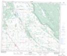
Maps showing Debden, 30-52-6-W3, Saskatchewan
Debden is a Village located in 30-52-6-W3, Saskatchewan and has an elevation of 518 meters.
- Latitude: 53° 31' 38'' North (decimal: 53.5272277)
- Longitude: 106° 52' 47'' West (decimal: -106.8797444)
- Topography Feature Category: Village
- Geographical Feature: Village
- Canadian Province/Territory: Saskatchewan
- Elevation: 518 meters
- Location: 30-52-6-W3
- Atlas of Canada Locator Map: Debden
- GPS Coordinate Locator Map: Debden Lat/Long