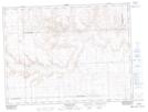
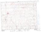
Maps showing Gunn Creek, 27-5-17-W3, Saskatchewan
Gunn Creek is a River located in 27-5-17-W3, Saskatchewan and has an elevation of 872 meters.
- Latitude: 49° 25' North (decimal: 49.4166875)
- Longitude: 108° 13' West (decimal: -108.2173481)
- Topography Feature Category: River
- Geographical Feature: Creek
- Canadian Province/Territory: Saskatchewan
- Elevation: 872 meters
- Location: 27-5-17-W3
- Atlas of Canada Locator Map: Gunn Creek
- GPS Coordinate Locator Map: Gunn Creek Lat/Long
Gunn Creek NTS Map Sheets