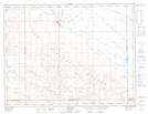
Maps showing Daleview, 30-4-18-W2, Saskatchewan
Daleview is a Unincorporated area located in 30-4-18-W2, Saskatchewan.
- Latitude: 49° 19' North (decimal: 49.3166987)
- Longitude: 104° 25' West (decimal: -104.4171949)
- Topography Feature Category: Unincorporated area
- Geographical Feature: Locality
- Canadian Province/Territory: Saskatchewan
- Location: 30-4-18-W2
- GPS Coordinate Locator Map: Daleview Lat/Long
Daleview NTS Map Sheets