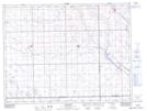
Maps showing Colgate, 19-5-14-W2, Saskatchewan
Colgate is a Unincorporated area located in 19-5-14-W2, Saskatchewan and has an elevation of 603 meters.
- Latitude: 49° 23' 40'' North (decimal: 49.3944730)
- Longitude: 103° 53' 42'' West (decimal: -103.8949682)
- Topography Feature Category: Unincorporated area
- Geographical Feature: Hamlet
- Canadian Province/Territory: Saskatchewan
- Elevation: 603 meters
- Location: 19-5-14-W2
- Atlas of Canada Locator Map: Colgate
- GPS Coordinate Locator Map: Colgate Lat/Long