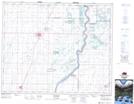
Maps showing Hague, 7-41-3-W3, Saskatchewan
Hague is a Town located in 7-41-3-W3, Saskatchewan and has an elevation of 512 meters.
- Latitude: 52° 30' 39'' North (decimal: 52.5107139)
- Longitude: 106° 25' 2'' West (decimal: -106.4173505)
- Topography Feature Category: Town
- Geographical Feature: Town
- Canadian Province/Territory: Saskatchewan
- Elevation: 512 meters
- Location: 7-41-3-W3
- Atlas of Canada Locator Map: Hague
- GPS Coordinate Locator Map: Hague Lat/Long