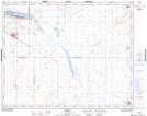
Maps showing Manitou Beach, 2-32-25-W2, Saskatchewan
Manitou Beach is a Village located in 2-32-25-W2, Saskatchewan and has an elevation of 510 meters.
- Latitude: 51° 43' 11'' North (decimal: 51.7198388)
- Longitude: 105° 26' 14'' West (decimal: -105.4371861)
- Topography Feature Category: Village
- Geographical Feature: Resort Village
- Canadian Province/Territory: Saskatchewan
- Elevation: 510 meters
- Location: 2-32-25-W2
- Atlas of Canada Locator Map: Manitou Beach
- GPS Coordinate Locator Map: Manitou Beach Lat/Long