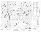
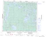
Maps showing Dockerill Lake, 76,77-8-W3, Saskatchewan
Dockerill Lake is a Lake located in 76,77-8-W3, Saskatchewan and has an elevation of 485 meters.
- Latitude: 55° 38' North (decimal: 55.6334231)
- Longitude: 107° 14' West (decimal: -107.2339913)
- Topography Feature Category: Lake
- Geographical Feature: Lake
- Canadian Province/Territory: Saskatchewan
- Elevation: 485 meters
- Location: 76,77-8-W3
- Atlas of Canada Locator Map: Dockerill Lake
- GPS Coordinate Locator Map: Dockerill Lake Lat/Long
Dockerill Lake NTS Map Sheets