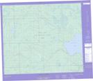
Maps showing Arsenault Lake, 70,71-17-W3, Saskatchewan
Arsenault Lake is a Lake located in 70,71-17-W3, Saskatchewan and has an elevation of 468 meters.
- Latitude: 55° 6' North (decimal: 55.1000869)
- Longitude: 108° 32' West (decimal: -108.5340656)
- Topography Feature Category: Lake
- Geographical Feature: Lake
- Canadian Province/Territory: Saskatchewan
- Elevation: 468 meters
- Location: 70,71-17-W3
- Atlas of Canada Locator Map: Arsenault Lake
- GPS Coordinate Locator Map: Arsenault Lake Lat/Long
Arsenault Lake NTS Map Sheets