Maps showing Qu'Appelle River, Saskatchewan
Qu'Appelle River is a River located in Saskatchewan and has an elevation of 424 meters.
- Latitude: 50° 29' North (decimal: 50.4833311)
- Longitude: 101° 29' West (decimal: -101.4837936)
- Topography Feature Category: River
- Geographical Feature: River
- Canadian Province/Territory: Saskatchewan
- Elevation: 424 meters
- Atlas of Canada Locator Map: Qu'Appelle River
- GPS Coordinate Locator Map: Qu'Appelle River Lat/Long
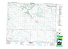
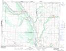
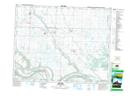
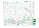
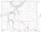
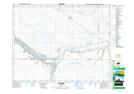
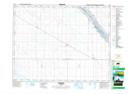
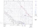
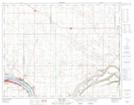
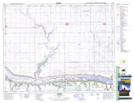
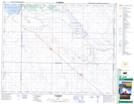
Qu'Appelle River NTS Map Sheets
062K05 Rocanville Topographic Map at 1:50,000 scale
062K06 Birtle Topographic Map at 1:50,000 scale
062K12 Spy Hill Topographic Map at 1:50,000 scale
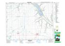
062L09 Esterhazy Topographic Map at 1:50,000 scale
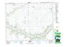
062L10 Crooked Lake Topographic Map at 1:50,000 scale
062L11 Lemberg Topographic Map at 1:50,000 scale
062L12 Indian Head Topographic Map at 1:50,000 scale
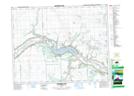
062L13 Fort Qu'Appelle Topographic Map at 1:50,000 scale
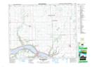
072I10 Lumsden Topographic Map at 1:50,000 scale
072I11 Bethune Topographic Map at 1:50,000 scale
072I12 Marquis Topographic Map at 1:50,000 scale
072I13 Aylesbury Topographic Map at 1:50,000 scale
072I15 Earl Grey Topographic Map at 1:50,000 scale
072I16 Cupar Topographic Map at 1:50,000 scale
072J16 Eyebrow Topographic Map at 1:50,000 scale
062K Riding Mountain Topographic Map at 1:250,000 scale
062L Melville Topographic Map at 1:250,000 scale
072I Regina Topographic Map at 1:250,000 scale
072J Swift Current Topographic Map at 1:250,000 scale