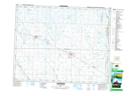
Maps showing Churchbridge, 17-22-32-W, Saskatchewan
Churchbridge is a Town located in 17-22-32-W, Saskatchewan and has an elevation of 524 meters.
- Latitude: 50° 53' 41'' North (decimal: 50.8948277)
- Longitude: 101° 53' 36'' West (decimal: -101.8932528)
- Topography Feature Category: Town
- Geographical Feature: Town
- Canadian Province/Territory: Saskatchewan
- Elevation: 524 meters
- Location: 17-22-32-W
- Atlas of Canada Locator Map: Churchbridge
- GPS Coordinate Locator Map: Churchbridge Lat/Long
Churchbridge NTS Map Sheets