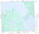
Maps showing Birch Point, 80-17-W3, Saskatchewan
Birch Point is a Cape located in 80-17-W3, Saskatchewan and has an elevation of 423 meters.
- Latitude: 55° 57' North (decimal: 55.9500872)
- Longitude: 108° 38' West (decimal: -108.6340607)
- Topography Feature Category: Cape
- Geographical Feature: Point
- Canadian Province/Territory: Saskatchewan
- Elevation: 423 meters
- Location: 80-17-W3
- Atlas of Canada Locator Map: Birch Point
- GPS Coordinate Locator Map: Birch Point Lat/Long
Birch Point NTS Map Sheets