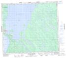
Maps showing Antoine Point, 81-16-W3, Saskatchewan
Antoine Point is a Cape located in 81-16-W3, Saskatchewan and has an elevation of 426 meters.
- Latitude: 55° 59' North (decimal: 55.9834224)
- Longitude: 108° 23' West (decimal: -108.3840504)
- Topography Feature Category: Cape
- Geographical Feature: Point
- Canadian Province/Territory: Saskatchewan
- Elevation: 426 meters
- Location: 81-16-W3
- Atlas of Canada Locator Map: Antoine Point
- GPS Coordinate Locator Map: Antoine Point Lat/Long
Antoine Point NTS Map Sheets