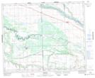
Maps showing Atton's Lake Regional Park, 44-20-W3, Saskatchewan
Atton's Lake Regional Park is a Conservation area located in 44-20-W3, Saskatchewan and has an elevation of 555 meters.
- Latitude: 52° 50' 0'' North (decimal: 52.8334065)
- Longitude: 108° 51' 48'' West (decimal: -108.8632107)
- Topography Feature Category: Conservation area
- Geographical Feature: Regional Park
- Canadian Province/Territory: Saskatchewan
- Elevation: 555 meters
- Location: 44-20-W3
- Atlas of Canada Locator Map: Atton's Lake Regional Park
- GPS Coordinate Locator Map: Atton's Lake Regional Park Lat/Long
Atton's Lake Regional Park NTS Map Sheets