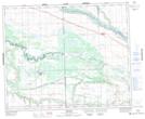
Maps showing Cut Knife Hill, Saskatchewan
Cut Knife Hill is a Mountain located in Saskatchewan and has an elevation of 560 meters.
- Latitude: 52° 50' North (decimal: 52.8334077)
- Longitude: 108° 58' West (decimal: -108.9673835)
- Topography Feature Category: Mountain
- Geographical Feature: Hill
- Canadian Province/Territory: Saskatchewan
- Elevation: 560 meters
- GPS Coordinate Locator Map: Cut Knife Hill Lat/Long
Cut Knife Hill NTS Map Sheets