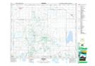
Maps showing Struthers Lake Regional Park, 45-23-W2, Saskatchewan
Struthers Lake Regional Park is a Conservation area located in 45-23-W2, Saskatchewan and has an elevation of 479 meters.
- Latitude: 52° 51' North (decimal: 52.8500235)
- Longitude: 105° 15' West (decimal: -105.2505142)
- Topography Feature Category: Conservation area
- Geographical Feature: Regional Park
- Canadian Province/Territory: Saskatchewan
- Elevation: 479 meters
- Location: 45-23-W2
- Atlas of Canada Locator Map: Struthers Lake Regional Park
- GPS Coordinate Locator Map: Struthers Lake Regional Park Lat/Long