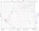
Maps showing Macklin Lake Regional Park, 38,39-28-W3, Saskatchewan
Macklin Lake Regional Park is a Conservation area located in 38,39-28-W3, Saskatchewan and has an elevation of 649 meters.
- Latitude: 52° 19' 40'' North (decimal: 52.3278485)
- Longitude: 109° 56' 23'' West (decimal: -109.9396597)
- Topography Feature Category: Conservation area
- Geographical Feature: Regional Park
- Canadian Province/Territory: Saskatchewan
- Elevation: 649 meters
- Location: 38,39-28-W3
- Atlas of Canada Locator Map: Macklin Lake Regional Park
- GPS Coordinate Locator Map: Macklin Lake Regional Park Lat/Long
Macklin Lake Regional Park NTS Map Sheets