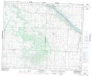
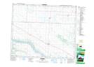
Maps showing Glenburn Regional Park, 40,41-12-W3, Saskatchewan
Glenburn Regional Park is a Conservation area located in 40,41-12-W3, Saskatchewan and has an elevation of 495 meters.
- Latitude: 52° 29' 50'' North (decimal: 52.4972798)
- Longitude: 107° 42' 2'' West (decimal: -107.7006463)
- Topography Feature Category: Conservation area
- Geographical Feature: Regional Park
- Canadian Province/Territory: Saskatchewan
- Elevation: 495 meters
- Location: 40,41-12-W3
- Atlas of Canada Locator Map: Glenburn Regional Park
- GPS Coordinate Locator Map: Glenburn Regional Park Lat/Long
Glenburn Regional Park NTS Map Sheets