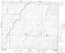
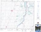
Maps showing Smuts Lake, 40,41-1-W3, Saskatchewan
Smuts Lake is a Lake located in 40,41-1-W3, Saskatchewan and has an elevation of 499 meters.
- Latitude: 52° 29' North (decimal: 52.4833702)
- Longitude: 106° 5' West (decimal: -106.0839103)
- Topography Feature Category: Lake
- Geographical Feature: Lake
- Canadian Province/Territory: Saskatchewan
- Elevation: 499 meters
- Location: 40,41-1-W3
- Atlas of Canada Locator Map: Smuts Lake
- GPS Coordinate Locator Map: Smuts Lake Lat/Long
Smuts Lake NTS Map Sheets