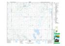
Maps showing Lucien Lake Regional Park, 40-23,24-W2, Saskatchewan
Lucien Lake Regional Park is a Conservation area located in 40-23,24-W2, Saskatchewan.
- Latitude: 52° 29' 10'' North (decimal: 52.4861363)
- Longitude: 105° 19' 2'' West (decimal: -105.3172082)
- Topography Feature Category: Conservation area
- Geographical Feature: Regional Park
- Canadian Province/Territory: Saskatchewan
- Location: 40-23,24-W2
- Atlas of Canada Locator Map: Lucien Lake Regional Park
- GPS Coordinate Locator Map: Lucien Lake Regional Park Lat/Long