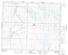
Maps showing Eagle Creek Regional Park, 37-10-W3, Saskatchewan
Eagle Creek Regional Park is a Conservation area located in 37-10-W3, Saskatchewan and has an elevation of 494 meters.
- Latitude: 52° 13' North (decimal: 52.2167164)
- Longitude: 107° 24' West (decimal: -107.4006390)
- Topography Feature Category: Conservation area
- Geographical Feature: Regional Park
- Canadian Province/Territory: Saskatchewan
- Elevation: 494 meters
- Location: 37-10-W3
- Atlas of Canada Locator Map: Eagle Creek Regional Park
- GPS Coordinate Locator Map: Eagle Creek Regional Park Lat/Long