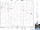
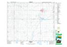
Maps showing Wolverine Creek, 33-36-22-W2, Saskatchewan
Wolverine Creek is a River located in 33-36-22-W2, Saskatchewan and has an elevation of 568 meters.
- Latitude: 52° 8' North (decimal: 52.1333601)
- Longitude: 105° 6' West (decimal: -105.1005534)
- Topography Feature Category: River
- Geographical Feature: Creek
- Canadian Province/Territory: Saskatchewan
- Elevation: 568 meters
- Location: 33-36-22-W2
- Atlas of Canada Locator Map: Wolverine Creek
- GPS Coordinate Locator Map: Wolverine Creek Lat/Long
Wolverine Creek NTS Map Sheets