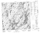
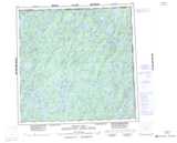
Maps showing Bell Bay, Saskatchewan
Bell Bay is a Bay located in Saskatchewan and has an elevation of 422 meters.
- Latitude: 59° 14' North (decimal: 59.2335125)
- Longitude: 102° 29' West (decimal: -102.4838210)
- Topography Feature Category: Bay
- Geographical Feature: Bay
- Canadian Province/Territory: Saskatchewan
- Elevation: 422 meters
- Atlas of Canada Locator Map: Bell Bay
- GPS Coordinate Locator Map: Bell Bay Lat/Long
Bell Bay NTS Map Sheets