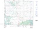
Maps showing Alingly, 16-51-27-W2, Saskatchewan
Alingly is a Unincorporated area located in 16-51-27-W2, Saskatchewan and has an elevation of 472 meters.
- Latitude: 53° 24' North (decimal: 53.4000452)
- Longitude: 105° 56' West (decimal: -105.9338424)
- Topography Feature Category: Unincorporated area
- Geographical Feature: Post Office
- Canadian Province/Territory: Saskatchewan
- Elevation: 472 meters
- Location: 16-51-27-W2
- GPS Coordinate Locator Map: Alingly Lat/Long
Alingly NTS Map Sheets