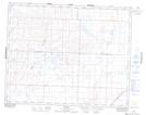
Maps showing Catherwood, 6-35-11-W3, Saskatchewan
Catherwood is a Unincorporated area located in 6-35-11-W3, Saskatchewan and has an elevation of 554 meters.
- Latitude: 51° 58' North (decimal: 51.9667131)
- Longitude: 107° 34' West (decimal: -107.5673202)
- Topography Feature Category: Unincorporated area
- Geographical Feature: Locality
- Canadian Province/Territory: Saskatchewan
- Elevation: 554 meters
- Location: 6-35-11-W3
- Atlas of Canada Locator Map: Catherwood
- GPS Coordinate Locator Map: Catherwood Lat/Long