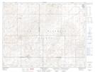
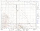
Maps showing The Dirt Hills, Saskatchewan
The Dirt Hills is a Mountain located in Saskatchewan and has an elevation of 684 meters.
- Latitude: 49° 59' North (decimal: 49.9833649)
- Longitude: 105° 18' West (decimal: -105.3005609)
- Topography Feature Category: Mountain
- Geographical Feature: Hills
- Canadian Province/Territory: Saskatchewan
- Elevation: 684 meters
- Atlas of Canada Locator Map: The Dirt Hills
- GPS Coordinate Locator Map: The Dirt Hills Lat/Long
The Dirt Hills NTS Map Sheets