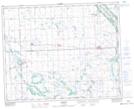
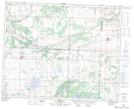
Maps showing Fort Pelly, 30-32-32-W, Saskatchewan
Fort Pelly is a Unincorporated area located in 30-32-32-W, Saskatchewan and has an elevation of 456 meters.
- Latitude: 51° 46' North (decimal: 51.7666563)
- Longitude: 102° 0' West (decimal: -102.0004633)
- Topography Feature Category: Unincorporated area
- Geographical Feature: Locality
- Canadian Province/Territory: Saskatchewan
- Elevation: 456 meters
- Location: 30-32-32-W
- Atlas of Canada Locator Map: Fort Pelly
- GPS Coordinate Locator Map: Fort Pelly Lat/Long
Fort Pelly NTS Map Sheets