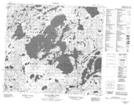
Maps showing Cabanel Bay, Saskatchewan
Cabanel Bay is a Bay located in Saskatchewan and has an elevation of 489 meters.
- Latitude: 56° 55' North (decimal: 56.9167626)
- Longitude: 107° 43' West (decimal: -107.7173358)
- Topography Feature Category: Bay
- Geographical Feature: Bay
- Canadian Province/Territory: Saskatchewan
- Elevation: 489 meters
- Atlas of Canada Locator Map: Cabanel Bay
- GPS Coordinate Locator Map: Cabanel Bay Lat/Long
Cabanel Bay NTS Map Sheets