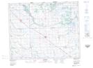
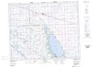
Maps showing Good Spirit Lake Provincial Park, Saskatchewan
Good Spirit Lake Provincial Park is a Conservation area located in Saskatchewan and has an elevation of 487 meters.
- Latitude: 51° 32' 5'' North (decimal: 51.5348481)
- Longitude: 102° 41' 3'' West (decimal: -102.6842902)
- Topography Feature Category: Conservation area
- Geographical Feature: Provincial Park
- Canadian Province/Territory: Saskatchewan
- Elevation: 487 meters
- Atlas of Canada Locator Map: Good Spirit Lake Provincial Park
- GPS Coordinate Locator Map: Good Spirit Lake Provincial Park Lat/Long
Good Spirit Lake Provincial Park NTS Map Sheets