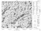
Maps showing Robertson Island, Saskatchewan
Robertson Island is a Island located in Saskatchewan.
- Latitude: 55° 47' North (decimal: 55.7834063)
- Longitude: 104° 47' West (decimal: -104.7837852)
- Topography Feature Category: Island
- Geographical Feature: Island
- Canadian Province/Territory: Saskatchewan
- GPS Coordinate Locator Map: Robertson Island Lat/Long
Robertson Island NTS Map Sheets