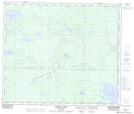
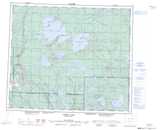
Maps showing Thunder Hill, 7,8-65-2-W3, Saskatchewan
Thunder Hill is a Mountain located in 7,8-65-2-W3, Saskatchewan.
- Latitude: 54° 37' North (decimal: 54.6167192)
- Longitude: 106° 14' West (decimal: -106.2338322)
- Topography Feature Category: Mountain
- Geographical Feature: Hill
- Canadian Province/Territory: Saskatchewan
- Location: 7,8-65-2-W3
- GPS Coordinate Locator Map: Thunder Hill Lat/Long
Thunder Hill NTS Map Sheets